Your go-to guide for the best cycling routes in Britain, don’t miss out on these scenic routes that take you through the best of the British countryside!
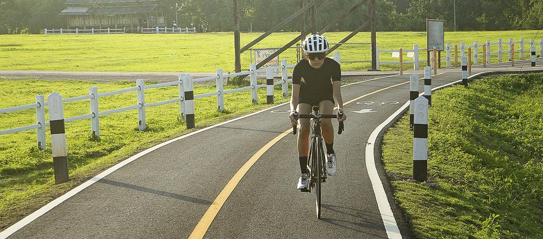
It’s easy to get out and about on your bike without having to hit roads filled with traffic. There are a range of largely traffic-free routes in the UK — from cycle lanes to converted old railway lines and forest tracks — that you can explore at your leisure. Some of these routes are suitable for the occasional cyclist, while others are tough tests for seasoned riders.
1. Crab and Winkle Way, Kent
Beginning in the World Heritage Site of Canterbury, Crab and Winkle Way in Kent passes through farms and woodland to the coastal town of Whitstable. The route takes its name from the old ‘Crab and Winkle’ railway line that ran between 1830 and 1952, and begins with a tour around Canterbury before heading into the Kent countryside. On the way, cyclists travel through Blean Woods, one of the largest areas of ancient broadleaved woodland in the south of the UK.
How difficult is Crab and Winkle Way?
The trail is gently undulating, and the newly-built path is gentle enough for a family outing. However, you’ll certainly be able to work up enough of an appetite to sample the local seafood (after which the railway was named). And if you don’t feel up to the ride back, you can get the train from Whitstable to Canterbury East station — although you will have to change at Faversham. Kent County Council have produced a leaflet describing the landscape and the wildlife that can be found along the route, which you can pick up at nearby Tourist Information centres.
Distance: 7.5 miles (approximately 12km)
2. The C2C (‘Sea to Sea’) cycle route
The C2C route is a coast-to-coast cycle ride across England which connects the Irish Sea to the North Sea. The route was opened in 1994 and starts at Whitehaven on the west coast of Cumbria before ending on the north east coast at Sunderland. The route travels through the northern Lake District before passing through Penrith and the Eden Valley, and then goes on towards the Northern Pennines. It then continues down into the Durham Dales before taking riders into the old industrial heartlands towards the North Sea and Sunderland.
How difficult is the C2C cycle route?
It’s best to ride this route from west to east in order to take advantage of the prevailing winds from the west — as well as have the gradients in your favour. Since it passes through the Pennines, there are some challenging climbs — the highest point being over 609 metres (2,000ft) — but it is suitable for recreational cyclists as well as the more committed bikers. Some sections of the route involve riding through exposed, isolated, upland areas — so be prepared!
Distance: 140 miles (approximately 225km)
3. The Camel Trail, Cornwall
The Camel Trail is traffic-free cycle route running through North Cornwall between the towns of Bodmin and Padstow, following the line of a disused railway.The cycle route runs along the Camel Estuary from Padstow to Wadebridge (6 miles or 9.65km), then on to Bodmin (14 miles or 22.53km), and finally on to the western edge of the rugged Bodmin Moor. There are even several bike hire shops in Padstow, Wadebridge and Bodmin to go to if you don’t have your own bike.
How difficult is the Camel Trail?
The Camel Trail is virtually level all the way due to it being laid on top of an old railway track. Although it doesn’t have a tarmac surface, it is mainly smooth, is ideal for cycling, and provides safe and easy access to the unspoilt countryside. Cyclists will be delighted that vehicles are banned from the trail — so it is perfect for families looking for a leisurely outing that is not too difficult. You should note that the link to the start of the trail from Bodmin Parkway is slightly more strenuous.
Distance: 17 miles (approximately 27km)
4. Reivers cycle route
Reivers cycle route is a challenging trail running from Tynemouth to Whitehaven. It takes cyclists from the North Sea through Northumberland and past Kielder Water — Europe’s largest man-made lake. From there, the route passes briefly into Scotland before moving south west to Carlisle and the Lake District, and then ending at the Irish Sea. The route is named after the marauding Reivers family clan who terrorized the border country in the fifteenth and sixteenth centuries.
How difficult is Reivers cycle route?
The length of the route — the majority of which is on quiet off road track and minor roads — makes it a challenge in itself, although its lacks the huge climbs of other routes such as the C2C. Cyclists will be against the prevailing wind the majority of the time if they ride east to west, which can make it difficult. However, the route is signposted for riding in both directions — so you could try traveling west to east instead, which will be easier.
Distance: 175 miles (approximately 282km)
5. Hadrian's Cycleway
A long-distance cycling route — the final completed section of which opened in July 2006 — that stretches the length of the Hadrian’s Wall World Heritage Site, linking Ravenglass on the Cumbrian coast to Tynemouth near Newcastle.The route takes in the Newcastle Quayside and the famous Tyne bridges before journeying out to the countryside via Wylam, Corbridge and Hexham, and then on to Carlisle. Several important Roman sites and museums are dotted along the route.
How difficult is Hadrian’s Cycleway?
Most of the route follows well-surfaced gravel cycle paths, tarmac cycle paths and quiet minor roads. Although there are no difficult off-road sections, there are a few steep, short hills in the central section, which feature climbs of up to 150m (492ft) in height). The route can also be ridden in the opposite direction. Of the total distance of the cycleway, approximately 71 per cent is on-road, while the other 29 per cent is off-road.
Distance: 160 miles (approximately 257.5km)
6. Loch Katrine, Trossachs, Scotland
A circular cycle route located in Rob Roy country that takes in a circuit around Loch Katrine — which formed the inspiration for Sir Walter Scott’s The Lady of the Lake.Cycling round the loch’s circumference of 12 miles (19.3km), which lies in the heart of the Trossachs, takes place on a paved private waterboard road. Bike hire is available from a mobile truck at Loch Katrine pier between April and October.
How difficult is the Loch Katrine cycle route?
The entire route is on-road — most of which is a single track. The first 5 miles (8km) are quite hilly, but should you become a touch too tired, there is always the option at the far end of the loch of taking the steam ship Sir Walter Scott back to the visitors center. Alternatively, you could get there in time for the morning boat and then cycle back. There’s also the added option of carrying on westward for a further 5 miles or so after Stronachlachar pier to Inversnaid, where you’ll get some fine views of Loch Lomond.
Distance: 12 miles (approximately 19km)
7. Tissington Trail, Peak District
The Tissington trail a scenic day cycle route in the heart of the Peak District National Park, running from Ashbourne to Parsley Hay. The trail follows the old Buxton to Ashbourne railway line and takes in some stunning limestone scenery. Tissington Trail also passes very close to Dovedale, Tissington, Hartington and other attractive places.
How difficult is the Tissington trail?
The cycling route is clearly signposted throughout. There are some steady but manageable climbs before reaching Parsley Hay, where cyclists can join the path to the High Peak Trail — but other than that it is not too strenuous to cycle along, with mostly very gentle climbs. The surface is limestone so is good in all weathers, and there are car-parking points for people wanting to join the trail at various stages. There are also shorter routes for people who do not wish to wander too far from the car parks along the White Peak Scenic Route.
Distance: 13 miles (approximately 21km)
8. The Taff Trail, Wales
The Taff Trail is a cycle route between Cardiff waterfront in the south and Brecon in the north. It passes close to Pontypridd and Merthyr Tydfil, through a wide variety of urban and suburban landscapes, and over the open moorland of the Brecon Beacons. A large proportion of the route uses former tramways, railways and canal towpaths — many of which have important historical significance to the industrial heritage of South Wales.
How difficult is the Taff Trail?
Cycling some parts of the route is very easy — and so these sections are suitable for novices and family groups. There are sections, however, that are remote and or or strenuous, and should never be started without taking the appropriate equipment and route maps, as well as taking into account weather considerations. A large proportion of the Taff Trail is designated ‘traffic free’, which makes it suitable for families when the weather conditions are good.
Distance: 55 miles (approximately 88.5km)
9. The Phoenix Trail, Oxfordshire
The Phoenix Trail is a shared-use path for cyclists, walkers and horse riders. It forms part of the national cycle network, and was constructed along part of the old branch railway line to Oxford. As well as providing a traffic-free route between the market towns of Thame and Princes Risborough, the trail is a haven for wildlife, offers good views of the Chiltern Hills, and also boasts a collection of award-winning sculptures by contemporary artists.
How difficult is the Phoenix Trail?
The Phoenix Trail has something for everyone as it is flat and surfaced for shared use by any number of walkers, cyclists or horse riders. It’s ideal as a quick and traffic-free cycle ride, and its frequent use makes it a great ride even if you’re going alone. The Phoenix Trail is actually a pretty good spot if you’re teaching a young child to ride a bike! The trail is best accessed via Princes Risborough train station.
Distance: 5 miles (approximately 8km)
10. Land’s End to John O’Groats
Cycling via any route from the tip of Cornwall to the top of the Scottish mainland. Land’s End to John O’Groats — the length of mainland Britain — is an ambition which many cyclists aspire to. The total distance depends on whether you want to take the scenic route or go by the most direct and less hilly route using largely ‘A’ roads.
A typical route would go from Land’s End, along the north Cornish coast, across Bodmin Moor and Dartmoor, and up through Cheddar Gorge. After crossing the River Severn, cyclists would pass through Herefordshire and Shropshire, and then head through the Yorkshire Dales and Cumbria before crossing the border into Scotland. Here, they would pass Loch Ness on the way to John O’Groats on the northern tip of the Scottish mainland.
How difficult is Land's End to John O'Groats route?
A good degree of fitness is required, as a typical journey will see you covering an average of around 65 miles per day over 15 days. The hillier stages are mainly near the start of the journey. You’ll also have to remember to plan your accommodation along the way in advance — so a good degree of thought needs to go into your ride as well.
Distance: approximately 1,000 miles (1,609km)!